
Hudson Bay Mountain Weather
Current Conditions
Thursday Jul 23, 2026 - 1:00 pm
19.9 °c | -- | Gentle Breeze
Thursday Jul 23, 2026 - 1:00 pm


 Air temp19.9 °c
Feels Like °c
Humidity %
Beaufort
Gentle Breeze
Gusts km/h
Cloud Height above station 1500 m m
Pressure Trend steady830.3 hpa
Today's Min°c
Today's Max°c
Month's Min°c
Month's Max°c
Smithers Airport25.0 °c
SunnyWSW 10.5km/h
valid 12:48 pm
today
last 24 hr
rate /hr
days
month
Resort Snow Table
Offline Summer
![]() Air temp19.9 °c
Air temp19.9 °c
SSE19 km/h
Feels Like humidex19.0 °c
Humidity36 %

Beaufort 3
Gentle Breeze
Gusts30 km/h
Snow TempNo Display-Off Season
 Air temp17.1 °c
SW20 km/h
Feels Like 17.1 °c
Humidity46 %
Beaufort 4Steady
Moderate Breeze
Gusts40 km/h
Smithers Airport25.0 °c
SunnyWSW 10.5km/h
valid 12:48 pm
![]()
High: 20°c Low: 12°c
clear
moderate winds ![]()
cm | mm | % | km/h | |
|---|---|---|---|---|
| pm | - | - | 0 | |
| night | - | - | 5 | |
| totals | 0 | 0 | ||
| Panorama Top pm/night | ||||
A mix of clouds and sun. Winds WNW at 25 to 40 km/h..
Partly cloudy skies this evening will become overcast overnight. Winds WNW at 25 to 40 km/h..


 on the mountain
Civil Sunrise
Civil Sunset
Nautical Sunrise
Nautical Sunset
Day length hr
Solar %
UV Index
Moonrise
Moonset:
Lunar Phase:
The weather server producing data for our primary weather station is down for maintenance. This requires an onsite visit and will be completed before next snow season.
 Hudson Bay Mountain
![]()
Forecast data is for the mid mountain elevation 1411 m (4629 ft) base of Panorama T-Bar
Winds at top represent elevation 1676 m (5499 ft) top of Panorama T-bar
Forecast Periods
am (Morning) 6:00 am to 12:00 pm
pm (Afternoon) 12:00 pm to 6:00 pm
Night 6:00 pm to 6:00 am
Forecast Data:12:28 pm
Narrative forecast by
![]() day time periods
day time periods
night time period
Thursday Jul 23, 2026 11:00 am
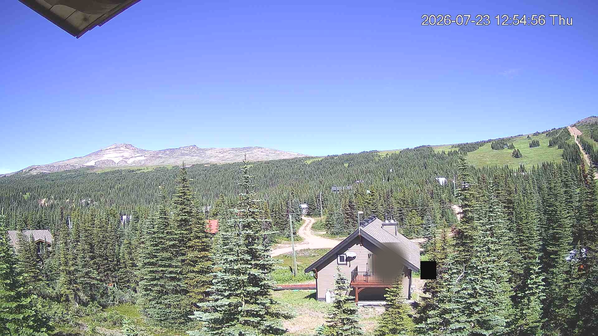
This weather station is located between the Panorama and Prairie T-Bar bullwheels. The data, we use temperature and wind, is uploaded hourly, on the hour via satellite. It is normally available for viewing shortly after upload, but maybe delayed longer.

![]()
Thursday Jul 23, 2026 - 1:00 pm
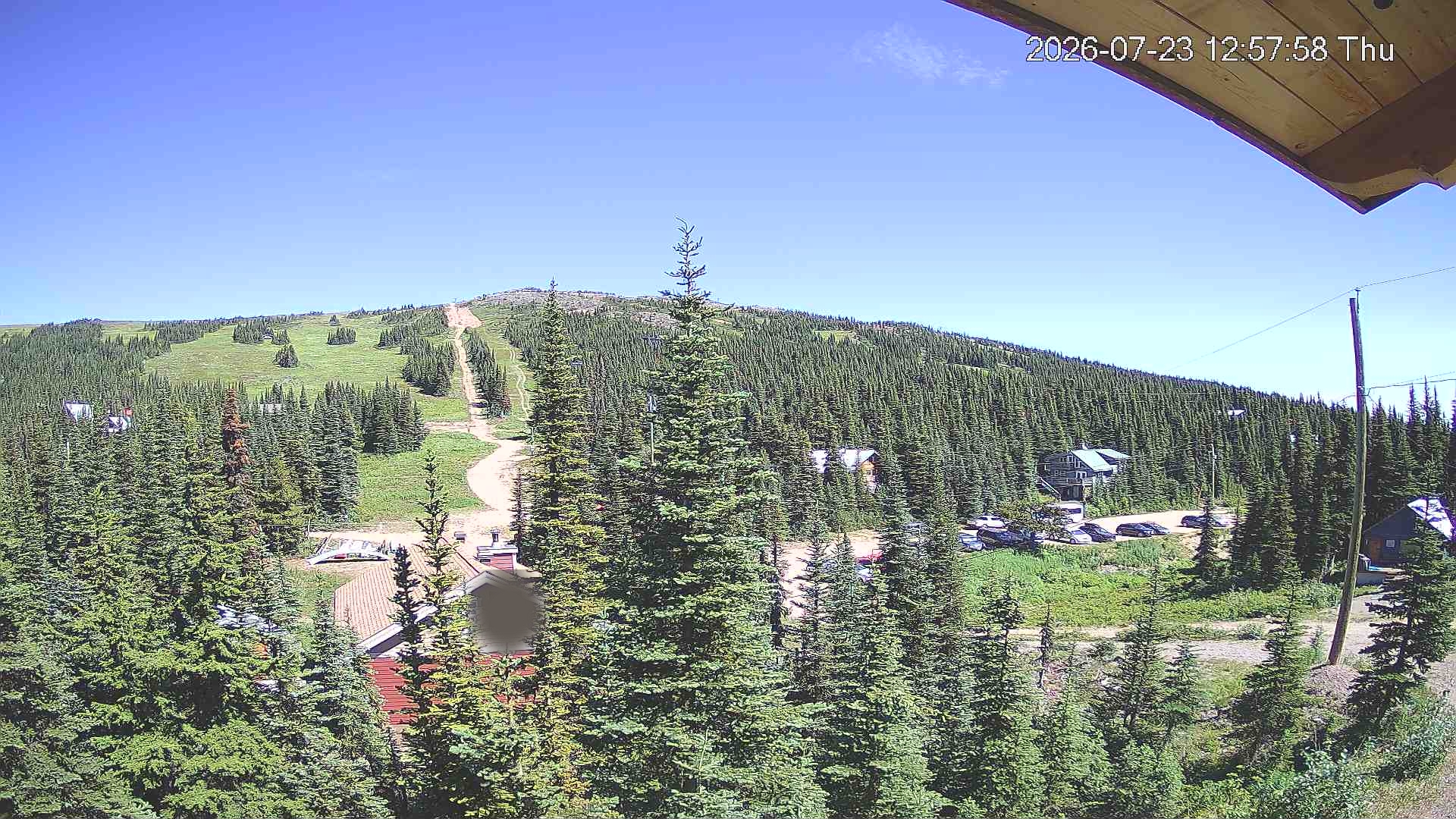
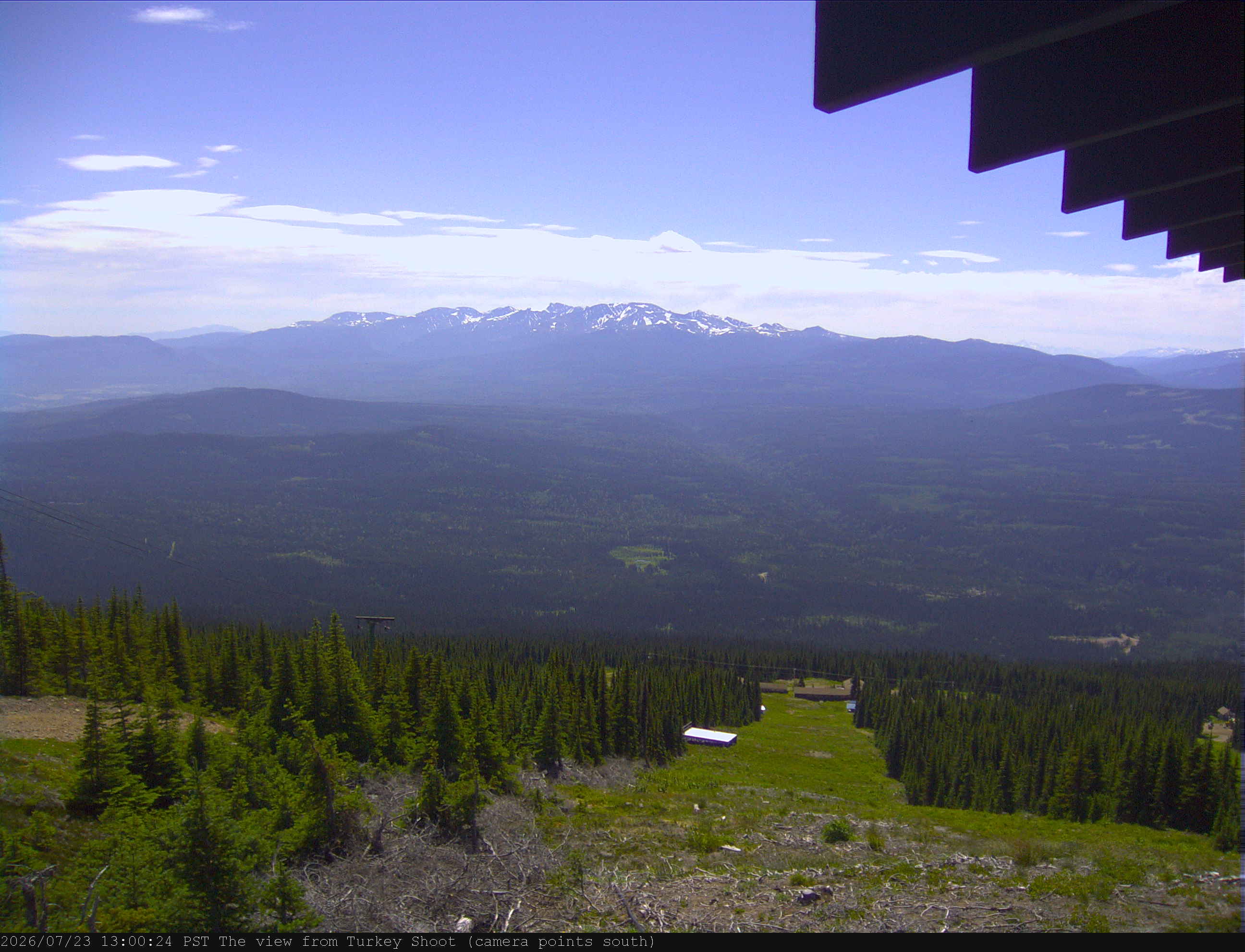
This weather station is located at the top of Turkey Shoot. Telus® has supplied the means to communicate with the internet and the site is maintained by ERM. This site hosts the data.
The camera tends to snow or ice over. It has a heater for lens clearing. The effect is much like a vehicle windshield left out overnight in the winter.
Club Image:1:00 pm
Club Data: 1:00 pm
Night time images used for our Sky Conditions and Ski & Snowboard Club are photos courtesy of Isaiah Douglas
Temperature sensors are located at the base area of these two lifts. Updated every 15 minutes.
Weatherapi.com (wapi) is a hourly service for current conditions. An alternative service is Openweathermap.org (owm). Both these services have an issue with reporting accurate Smithers Airport temperatures. So, supplemented every quarter hour for temperature and wind from the Government of Canada (ec).